Gilgit


Gilgit is a located at an altitude of Approximately  1500 Meters (4800 Feet) in the North east of Pakistan . The city had been a central point of trade and political activity as early as 1st century AD. Since then it has always been a very strategic point for the neighboring countries. Surrounded by the massive mountains of Karakorums Gilgit is a small valley with a ground just enough to form a small city of 500000 persons. Beyond here there is no such a big town or city in any direction within a distance of about 450 Kilometers in any direction. Gilgit is the administrative and commercial capital of Northern areas.
Mountains of the region are known to be the highest and greatest in the Number around the world. Stretch of Gilgit comes in the rain shadow of Nanga Parbat Mountain i.e. The moon soon winds are blocked by the massive of Nanga Parbat and clouds can not reach Gilgit which makes it dry & rugged but the labor of the strong and willing local population has even claimed the hard mountains for cultivation's. Due to this there are beautiful green orchids of many fruits in the valley. This makes an spectacular contrast in the green fields and ruggedness on the mountains topped with white snow a scenery only found in the northern areas of Pakistan.
The road to Gilgit is an other adventure and beauty filled experience Karakorum Highway built Between 1966 to 1978 by the Chinese and Pakistani engineers, above the shoulders of gigantic mountains of Himalayas , Hindukush & Karakorum ranges. More than five hundred lives are buried under this marvelous road which is known all over the world for its beauty and variation in terrain and culture. The highway runs along the river Indus and later continuous to Gilgit on Gilgit river.
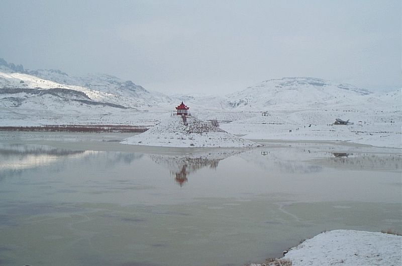
Each stop of this highway will definitely force you to admire it. There are nice PTDC motels on main points and towns of the Highway.


An Ideal Itinerary will to take go from Islamabad to Besham overnight at PTDC motel Besham is located on the Bank of Indus river. Later you continue to Gilgit With several photo stops on the way. There are also some interesting Rock drawings from the Buddhist period along the road.

Flights to Gilgit are depending on weather so are not advisable for a good reliable tour. Road Journey is much scenic and more reliable.

Hunza Valley


Hunza is probably Pakistan's most visited valley, by the tourists. It is a fairy tale land surrounded by beautiful rugged & snow capped mountains. Only at a distance of 100 Kms. from Gilgit Hunza is a small town on Karakorum Highway. At the altitude of 7000 - 800 feet it is the first main town or stop if you are entering Pakistan from China.
The central Hunza known as Karimabad is basically a town of just 6 villages. The first main villages as you come from Gilgit on the main Karakorum Highway is Aliabad. There there are spectacular views of  Rakaposhi mountain (7788 meters), PTDC Motel Hunza and other small hotels are located on the main Karakorum highway here. Just above Aliabad on the hill are Altit and Baltit villages the heart of Hunza. There is a very interesting Bazaar and two Forts in Altit & Baltit Villages. The Baltit fort has recently been restored and converted into a guided museum.
Hunza is undoubtly the Shangri-la of James Hilton's novel The Lost Horizon. It is probably the most Photogenic point in the world.


Places in Hunza

Karimabad: As described above is the main bazaar of Hunza full of colorful shops with local dry fruits (Dried Apricots, Apricot Nut, Almonds, Walnuts Mulberry, etc.) At the end of bazaar is the Baltit village and Baltit fort which are restored by the Aga Khan fund for Culture & heritage. The fort has been brought into a guided museum you can spend time in the for visiting different sections of the fort and viewing the slide show in the small hall of the fort.
Duikar: At an height of 10000 feet above sea level this is a beautiful spot to see sunrise. You can see 8 peaks above 7000 meters from here each gets the sun light one by one as sun rises.


Quetta

کوئٹہ 


Quetta lies at the altitude of 1,675 meters. It is a small city of about 1 Million people. It is one of the few planned cities of Pakistan. The pleasantly tree-lined streets of Quetta are all rebuilt after the earthquake of 1935, The city offers little historical interest Except the Museum at Toghi Road which houses the artifacts from Mahargarh 9000 years old village culture of Pakistan, though the food and goods on sale in the bazaars give it a certain Central Asian feel and a reason to see it. Afghan refugees have brought with them fresh crafts like the distinctive Hazara rugs, to add to such traditional items as Balouch mirror work, wooden crafts from Sind & Punjab and many other merchandise from Iran & Afghanistan.
In the cantonment north of the city is Staff College , there is a small military museum in a bungalow once occupied by Field- Marshal Montgomery when he was an instructor at the Quetta Staff College, it is the academy which trains Pakistan's military elite . The same route out of town leads after 11 kilometers to a Hanna Lake, which is a scenic lake with beautiful picnic spots around it. If you continue 22 kilometers on the same road there are the orchards of Urak Tangi. An other great spot to have a relaxed picnic under the apples & pomegranates orchids.


Mirpurkhas


Mirpurkhas is the South eastern city of Pakistan and Sindh Province. Its fertile and very popular for it mangoes. The city is built on or may be just beside an old Buddhist metropolis of 4th century AD. There are remains of an Stupa from 4th century near Mirpurkhas known as "Kahoo o Daro",  Mirpurkhas is only 70 Kilometers from Hyderabad and has a quint little bazaar which sells traditional garments and modern crockery etc.
The city also has a Satellite town which is considered a posh area. The city is considerably clean and has many places to hang around like Parks museum Tea shops and a very famous Fruit & Horticulture research Institute & Farm.
Most people speak Sindhi but there is a substantial number of Urdu Speaking New Shindhis or the immigrants from India, who came in 1947.


There are about 60% Muslims and 40% Hindus in the city & Surroundings

Hyderabad

Hyderabad is second largest city of Sindh Province. It has over 6 Millions population. The city has one of the most interesting bazaar of the country, The Resham Gali Bazaar which is known to be the longest bazaar in Asia. There are two very well arranged ethnological museums in the city One is The Sindh Museum and the other is Institute of Sindhology Museum. Both museums present an excellent portrait of cultural and tribal life of Sindh. The city is transit point for the tours from Karachi to the interior of Sind A visit to Kalhora Monuments close to the city gate is worth a visit , Mausoleums are beautifully decorated with glazed tiles and frescos. There are also two forts from 18th & 19th century to see here.

Sindhology Museum has recently made an extensive gallery about Shaheed Benazir Bhutto where a large collection of her relics including dresses, books, awards pictures and numerous objects are kept.

Sukkur

Sukkur is the central city of Sindh province, It is located on the west bank of the river Indus. The city is the starting point for all the archeological sites in Sindh. There is also a very busy central Bazaar in the city which attracts people from all over the Sindh province. Sukkur is also the home for Masoom Shah Jo Munaro (Minaret of Masoom Shah) a leaning tower constructed in 18th century by historian Masoom Shah Bakhri who also ruled the city for a short period. There are some of the most respected relics of hidus in the city which include the Asthan of Kalka Devi and the Sadh Belo the asthan of Baba Bankhandi located on Sadh Belo Island in the river Indus.
Sukkur is also home of the rare dolphin specie the Indus Dolphin which lives in the silty water of the Indus and found most at Sukkur.
The best thing to buy is Dates which are really a good gift from here. One can also hunt for colorful handicrafts and Ajraks here.
Sukkur is also the narrowest point of the lower Indus. Hence it was here English made first barrage on the Indus in 1932. (Lloyd Barrage) 7 Canals were dig to distribute water in all parts of the province which eventually made Pakistan to have the longest irrigation system of the world. With 38000 miles of irrigation canals known as Indus Food System.

Sahiwal

Sahiwal  is a city in Punjab province of Pakistan. It is in the vicinity of the ancient Indus civilization city Harrappa (3300 BC - 2500 BC) In a way it can be called the Harrappa of today. Sahiwal is a busy city with houses made of red brick walls just like Harrappa. It is said Sahiwal is built on top of a large portion of the ancient Harrappan mound. Many of the streets and houses of the modern town are built directly above the ancient streets and houses of ancient Harappa.
In 1865 during the Raj times here was a small villaged on the Karachi-Lahore railway line. Tt was named Montgomery after Sir Robert Montgomery, whi later became Lieutenant-Governor of Punjab.
Sahiwal took its current name in 1966.It is the administrative centre of Sahiwal District and Sahiwal Division. The districts of Okara and Pakpattan are under Sahiwal division. Sahiwal lies approximately 180 km from the major city of Lahore. And it is the biggest city between Lahore and Multan. The population is 207,388 (1998 Pakistan Census). Sahiwal District is included in the former Multan Division and lies between 30-39 north latitude and 73-06 longitude. The city lies in the densely populated region between the Sutlej and Ravi rivers. Irrigation in the region is provided by the Bari Doab Canal system. The principal crops are wheat, cotton, tobacco, legumes, and oilseeds.
Cotton goods and lacquered woodwork are manufactured. About 18 miles Southwest of Sahiwal is Harappa, an ancient city of the world, oldest urban center of Harappan or Indus civilization in South Asia. About 28 miles (45 km) west of Sahiwal, at Kamalia, is the site of a Malli city captured by Alexander the Great in 325 bc. Pop. (1998) city, 207,388. The people of Sahiwal are known as Sahiwalians. This city got his name from the first inhibitors of this city the sahis (a jutt sub-tribe or cast).
Sahiwal to Lahore :
It takes about 4 - 5 hours the drive is thrugh the fertile planes of punjab. One can see the life of villages alsong the road and can also stop at a village to see the suger can balls being made or Just for a cup of tea.
Sahiwal to Multan :
Around 4 - 5 hours journey along the National highway

Multan

Total Population
1,606,481

Total Area
3,721 km2 (1,436.7 sq mi)


Official Website Link:

Rawalpindi

Total Population
1,991,656

Faisalabad

Total Population
2,880,675

Karachi

Total Population
13,205,339

Total Area
3,527 km2 (1,361.8 sq mi)


KARACHI : Pakistan’s former capital and its largest city, Karachi is situated on the shores of the Arabian Sea near the mouth of the Indus. The capital of Sindh Province, it is now a modern industrial city and Pakistan’s major port. Though not strictly a tourist centre, there are a number of attractions, such as the fish wharf where brightly-coloured boats bring in seafood, one of the country’s major foreign exchange earners. There are hundreds of lively street restaurants, tea houses, samosa and juice stalls. Boats can be hired to sail out of the harbour. There are architectural reminders of the former British Imperial presence, especially in the clubs. The most magnificent building, however, is the Quaid-e-Azam’s Mazar, the mausoleum of the founder of Pakistan, made entirely of white marble with impressive north African arches and magnificent Chinese crystal chandeliers. The changing of the guard, which takes place three times a day, is the best time to visit. Other places to visit are the National Museum, parks, the zoo and a beach at Clifton.


Official Wesite Link:


Lahore Railway Station

Connections : Bus Stand, taxi Stand,
Structure : Standard (On Ground Station)
Platforms : 11
Track : 11


The Lahore Railway Station in Lahore, Punjab, Pakistan was built by British colonists between 1859-1860 at the cost of half a million Rupees. It is of typical grand British architecture in South Asia during the British Raj period. The railway network established by the British was extensive and is one of their lasting contributions to the culture and infrastructure of this region.
The railway station has 11 platforms (1 to 9, with 2 extra platforms, 3A and 6A). Platform No. 1 is of special importance, as this platform is the destination of "Samjhauta Express", the train service between Pakistan and India.


History


Lahore Railway Station was literally the first purpose-built British imperial building, its foundation stone haying been laid by John Lawrence in 1859, and it cost half a million rupees to build.

Lahore Railway Station is representative of typical grand British architecture in the Indo-Pak subcontinent during the British Raj. The railway network established by the British was very extensive and is one of their lasting contributions to the culture and infrastructure of this region. With its great round bastions and tall machicolated towers, Lahore station may look as if it is the product of some short lived collaboration between the Raj and the Disney Corporation, but it was in fact built in deadly earnest. The twin towers look as innocent as Swiss cuckoo clocks, but they were designed to be bomb- proof, while the loop holes across the facade are not the mock arrow slits they appear to be, but placements for Maxim guns, which were drawn down carefully designed lines of fire. Even the cavernous train sheds could, in an emergency, be sealed with huge sliding metal doors, turning the whole complex into a colossal fortified bunker. According to its architect, William Brunton, the whole station had a "defensive character" so that "a small garrison could secure it against enemy attack".

The station was built in the immediate aftermath of the Indian Mutiny of 1857. So the building was deliberately designed to function both as a station and as a fort. At the time one of the major concerns was the safety of railway employees, and accordingly, the building was designed to provide accommodation for "refuge of the Railway staff and others in any time of danger." Constructed entirely of brick masonry, its quaint square turrets rise above the main structure and carry large clocks which could be visible from great distances, once again underscoring the importance of time that an industrialized society such as England was keen to inculcate in the local public.

The earliest of the Raj structures of Lahore, few railway stations can present a picturesque view such as this. The station provides a grand setting for the important railway junction that Lahore became ever since the first train was run to Amritsar in 1860. Later, when linkages had been established with Bombay, Calcutta and Peshawar, and in 1889 with Karachi, Lahore contributed significantly to making Karachi the largest exporter of wheat by transporting wheat from Punjab's canal colonies.

During the Second Anglo-Afghan War (1878), Lahore played a key role by facilitating the passage of 75 trains every 24 hours to carry troops and provisions to the war destination.

Facilities

The Lahore railway station has all the facilities which a large station like it must possess. Food stalls, book agencies, drink corners, and the like are found on every platform. Some foreign restaurants (like  McDonald's and Pizza Hut) have their branches at platform No. 2.

Pakistan Railways official site

DASKA City

                                                                          DASKA


Calling Code: 052
Postal Code: 51010
Time Zone: PST ( UTC+5 )


Daska ( Urdu: ڈسکہ,  Punjabi: ڈسکا) is a growing industrial city with a population of around 300,000 in the Punjab province of Pakistan. The town is the capital of Daska Tehsil one of four tehsils of Sialkot District. It is located at 32°19'60N 74° 20' 60E

NAME

The name Daska is said to be a distortion of "Dah Kos". The term "Dah" is the Persian word for the numeral ten, and "Kos" refers to a unit of distance used in Mughal times. The town was situated some ten "Kos" between neighbouring Gujranwala, Sialkot, Pasrur, Wazirabad and Sambrial, hence Dah Kos became Das Kos in the local Punjabi language, later shortened to Daska.
The principal Jatt clans of Daska and its environs include the Jatt, Mughal, Sahi, Maher, Ghumman, Nagra, Wahla, Basra, Kang, Goraya, Bajwa,Cheema and Randhawa. The Jatts are said to have originated from Scythian invaders from Central Asia. Some people have wrongly confused Jatts with Chaudries which is simply an honorific given to land owners.The Mughals are also there, they have major role in the manufacturing industry of daska.The Rajputs are represented in the local population mostly by Khokhars and Rana's. From Middle Ages, some Ghauris, originally from Afghanistan and having Hazara roots are also inhabitants of this area. A large number of Pathan (Kakars) and Afghan descendents of early ages, who had been living in Indian part of Punjab, migrated to Pakistan; and a good number of these people are living in Daska and around though it is hard to distinguish them by the language, as all of them are deeply integrated into Punjabi culture and so speak Punjabi as their mother tongue. A large numbers of  Salahriya, Kashmiris, Maliks, Gujjars, and Thareem are part of local population. A number of Biharis from Eastern India have reached here and have settled down as locals since 1971 and some Afgan refugees have also made this area as their home late 70's after Soviet invasion of Afghanistan. This makes Daska a land of all colours where all are living in examplery harmony. In fact Daska may be taken as a role model for the rest of the country.The nearest village name bhroke which was founded by late sardar jawala singh sahi before 1930s ,which was left by there grandons(sh.gurcharan singh sahi) during 1947 ,which are now living in kharar ,punjab ,india(http://www.daskacity.com)
The local dialect of Punjabi is the Western or Northern Dialect akin to that spoken in Sialkot. A native speaker from Daska and Sialkot District will easily recognize another native speaker of the area due its rhythmic melodious sound, the use of several distinct words and aspects of syntax.
The name Daska sounds very familiar in Serbian (Croatian, Macedonian) and means batten or sill. This is maybe in connection to Alexander the Great (Alexander III of Macedon).


History

Before the independence of Pakistan in 1947, the city of Daska was under British colonial rule. Daska became famous largely due to the exploits of  Jagga Daku who was an admired rebel leader and outlaw fighting against British Imperial rule. In the Punjab he came to be admired as a hero to the masses because of his brave stand against the European rulers. Much like Robin Hood, he would loot from the wealthy and redistribute this wealth to poorer sections of society. Most of the wealthy in the area around Daska were native collaborators of the colonial British. Jagga has a prominent place in Punjabi poetry because of his bravery and generosity.
Daska's role in the organized freedom movement is well documented. The nascent sense of nationalism among Punjabi Muslims evolved in the area. The people of the Punjab were a mixture of races and peoples who had been part of a number of kingdoms and territories over the course of history. The area around Daska had been part of Alexander the Great's Greek Empire, Persia's grand Khorasan, the Turkic Mughal Empire and most recently the rule of Sikhs before the arrival of the colonial British. The panoply of peoples living around Daska bear living testament to its storied past. The British Indian Empire added these people to its realm in the latter half of the 19th century unlike other parts of the British Raj which were under British rule from as early as the 17th century. The local people around Daska, especially the majority Muslim population, related little to the Indian National Congress which was primarily a party of the Hindu majority in peninsular India. It became clear that with the departure of the British, the recreation of a Mughal Empire or Muslim dominated state in South Asia was not in the cards. Daska embraced the cause of the Muslim League which was furthering the struggle of native Muslims in an independent state. The first meeting of the Muslim League in Daska was held on April 13, 1942 at Mian Lal Dian and Mian Jalal Din Ghumman's house in Mohallah Altaf Garaha.
The city has gained a measure of prominence due the large number of products which are produced there, including agricultural machines, sporting goods, musical instruments and surgical goods. The area around the city is well known for farming and cottage industries.
Mooranwalee Kothi (Peacock mansion) is a distinctive building in Daska. It was built during the 1930s by a prominent Sikh family who later migrated to India in 1947. For many decades, the building was famous in the region for its grandeur, gardens and of course peacocks.


Transportation

The city is accessible by road from all major cities. The nearest railway station is about 17 km (11 mi) away (Sambrial railway station).


Sialkot International Airport

Sialkot International Airport is the closest airport, 15 km away from the city centre. It currently handles only cargo but passenger flights are planned to start at the end of 2009. On September 28, 2007, Airblue operated its first test flight to Sialkot. The aircraft was an A321, (AP-BJB) with more than 30 passengers on the route between Jinnaj and Sialkot.
Pakistan International Airline (PIA) has announced its tentative flight schedule for flights between Islamabad-Sialkot-Islamabad. PIA started initially three flights weekly between Islamabad-Sialkot-Islamabad.


References

Pakistani Weddind Style